Copyright for the images is with the authors. Please get in touch if you are interested in using any of our photos.
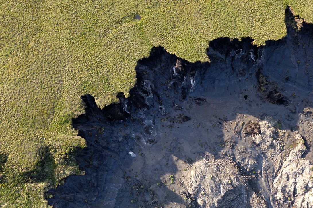
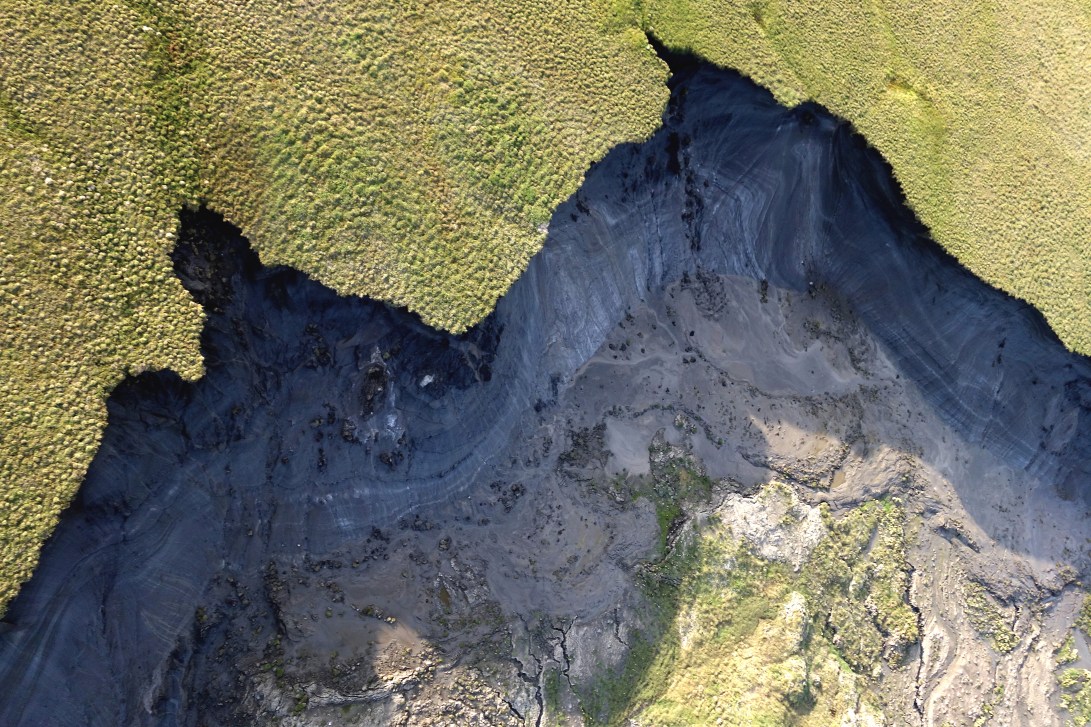
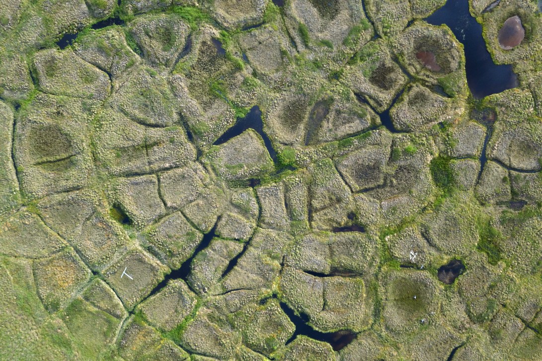
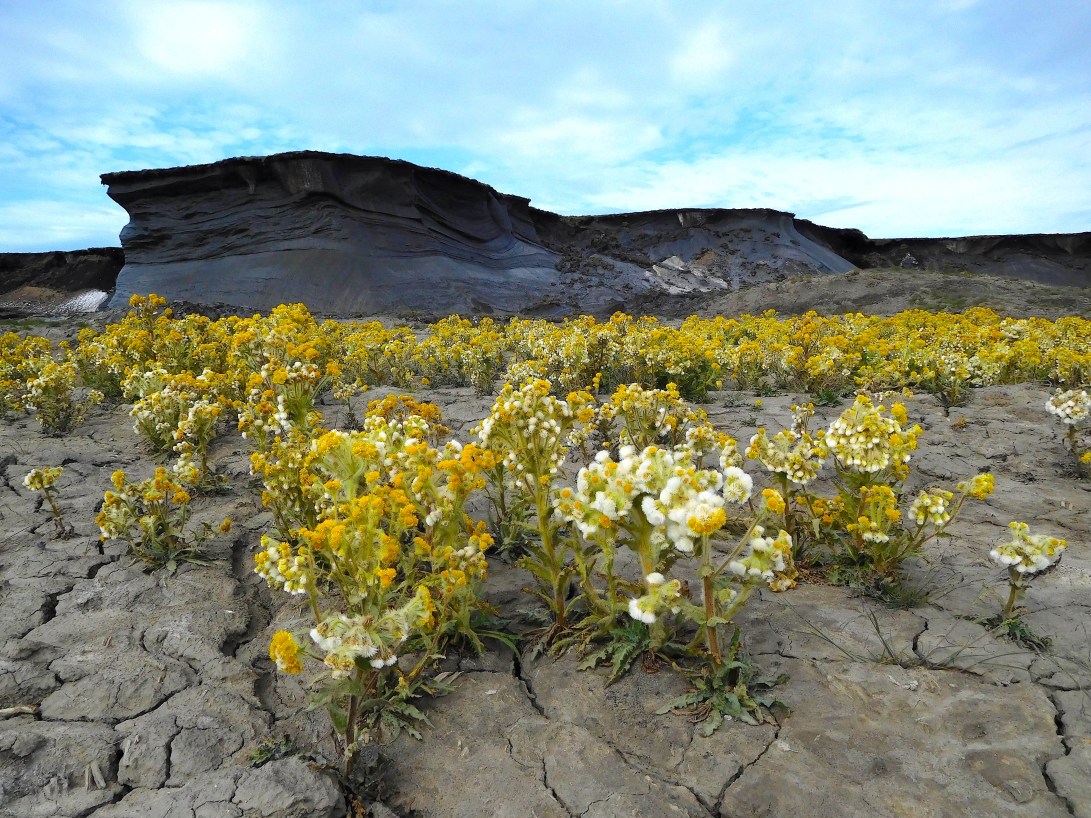
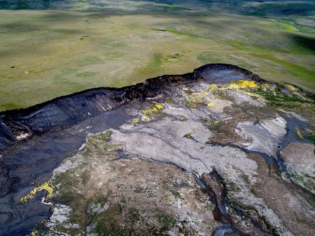
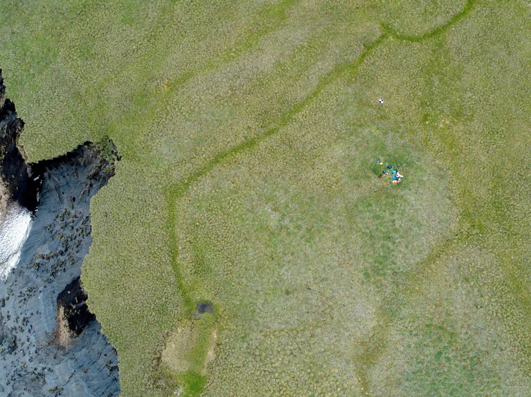
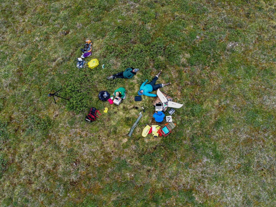
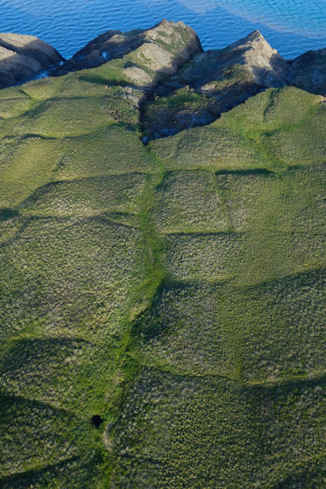
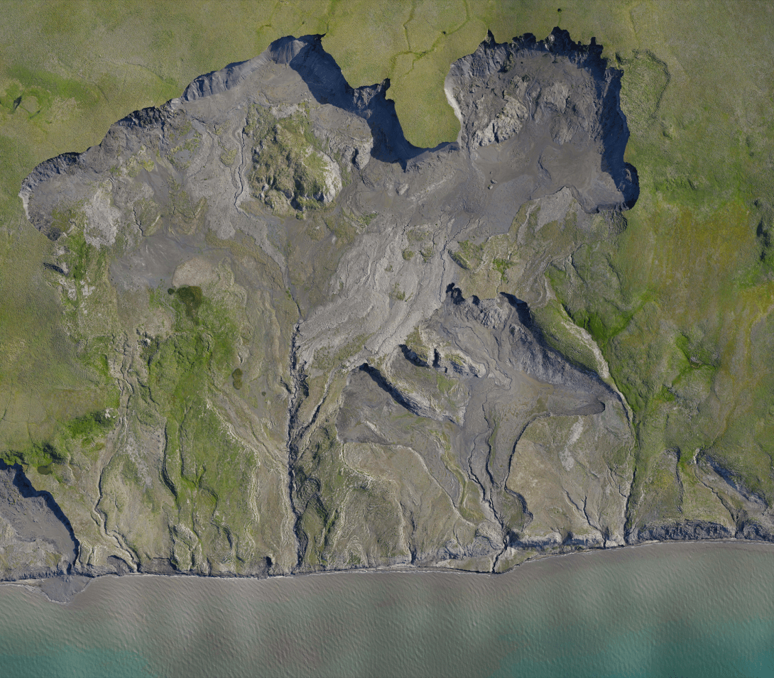
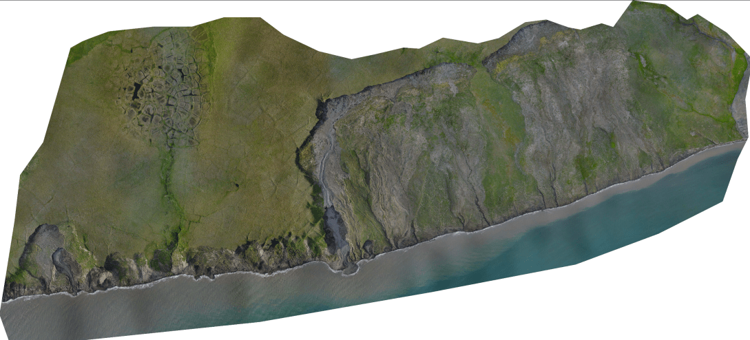
A drones-eye view of the saw-toothed edge of the ice cliff at ‘Slump D’, one of the largest retrogressive slumps in North America. This thaw slump is retreating into the undisturbed tundra at a rate of approximately 14 metres per year, causing huge volumes of ice and soil to be lost to the ocean over time. Photo credit: Jeffrey T. KerbyCollapsing ice cliff. As thawing exposes more and more frozen ground each year, the tundra collapses forming a huge ice cliff, known as a retrogressive thaw slump. By capturing this feature using drone imagery, we can map the 3D structure of the thaw slump and the rate of change over time. Photo credit: Jeffrey T. KerbyIce wedges form over thousands of years along cracks in the ground. Each summer cracks fill with water. Each winter this water freezes and expands the cracks. Year on year, this cycle creates wedges of ice, sometimes penetrating deep into the soil. On the surface ice wedges ofen create five-sided polygon shapes, around 10 meters in diameter, that can pattern the landscape for hundreds of kilometres along coastal floodplains. Photo credit: Jeffrey T. KerbyAs thaw slumps stabilise, plants start to grow on the fresh, rich soil. One of the first to invade is the Mastodon flower (Senecio congestus), a type of disturbance-loving Arctic daisy emerging from a prehistoric story-book. Photo credit: Isla H. Myers-SmithRetrogressive thaw slumps are impressive thaw disturbances in permanently frozen ground known as permafrost. This retrogressive thaw slump, ‘Slump D’, spans over two kilometres across with a headwall (the ice cliff) of almost 40 metres. Photo credit: Isla H. Myers-SmithRetrogressive thaw slumps are impressive thaw disturbances in permanently frozen ground known as permafrost. This retrogressive thaw slump, ‘Slump D’, spans over two kilometres across with a headwall (the ice cliff) of almost 40 metres. Photo credit: Isla H. Myers-SmithTeam Drone, the drone researchers on Team Shrub, are captured from the air while surveying ‘Slump D’. Drones enable us to monitor rates of permafrost thaw and collapse over the summer and from year to year. Photo credit: Andrew C. CunliffeA drones-eye view of Team Shrub hard at work. Drone research is difficult and intense…but occasionally offers the chance for some members of the team to snatch a relaxing tundra nap. Photo credit: Andrew C. CunliffeThe tundra landscape of the Western Arctic is often underlain by permafrost rich in ice. Here on Qikiqtaruk – Herschel Island 1000-year-old ice wedges are visible just beneath the surface, creating the patterns in the landscape that are so clearly visible from the air. Photo credit: Jeffrey T. KerbyAlong the coastline of Qikiqtaruk-Herschel Island near the Pauline Cove settlement, we observed approximately 15 metres of coastal erosion in a 40 day period in the summer of 2017. This rapid rate of coastal erosion has not been observed on the island in recent decades. Here, you can see the blocks of permafrost soil breaking off at the beach and a stream flowing as a waterfall from the floodplain into the Beaufort Sea. Photo credit: Isla H. Myers-SmithThis is an orthomosaic – the stitching together of multiple photographs – of over 1000 individual images of a two-kilometre section of the coast of Qikiqtaruk – Herschel Island. This slump is one of the largest retrogressive thaw slumps in the Western Arctic with a head wall – the ice cliff – of around 40 metres in height and around two kilometres in extent, making it a massive disturbance feature on the landscape. Photo credit: Jeffrey T. KerbyThis is an orthomosaic – the stitching together of multiple photographs – of over 1000 individual images of a one-kilometre section of the coast of Qikiqtaruk – Herschel Island. Several retrogressive thaw slumps – areas of collapsed tundra – scar the coastline. Here the coast changes rapidly with mud cliffs eroding away each year and continuously losing sediment to the ocean as the permafrost thaws. Photo credit: Jeffrey T. Kerby
Fly around one of North America’s largest permafrost disturbance features – the retrogressive thaw slump known as ‘Slump D’ – from the perspective of a drone.
Photo credit: Jeffrey T. Kerby
Copyright for the images is with the authors. Please get in touch if you are interested in using any of our photos.