Copyright for the images is with the authors. Please get in touch if you are interested in using any of our photos.
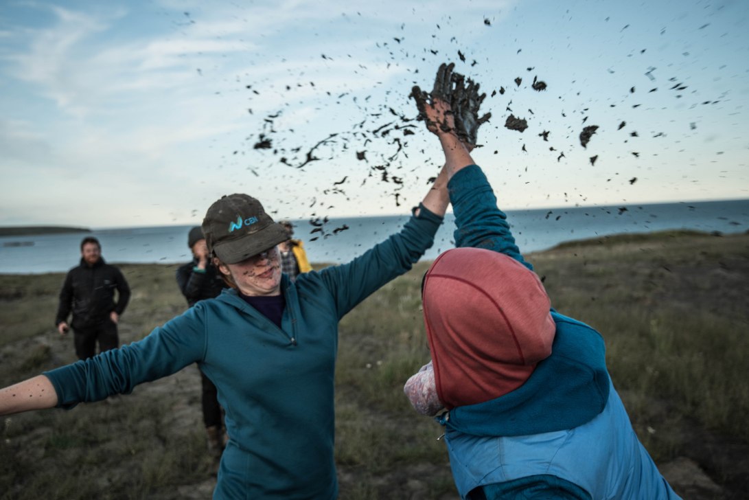
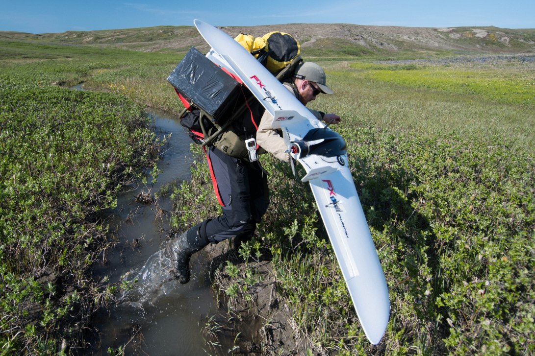
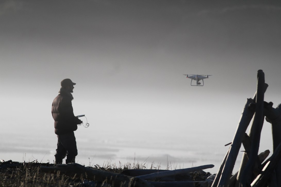
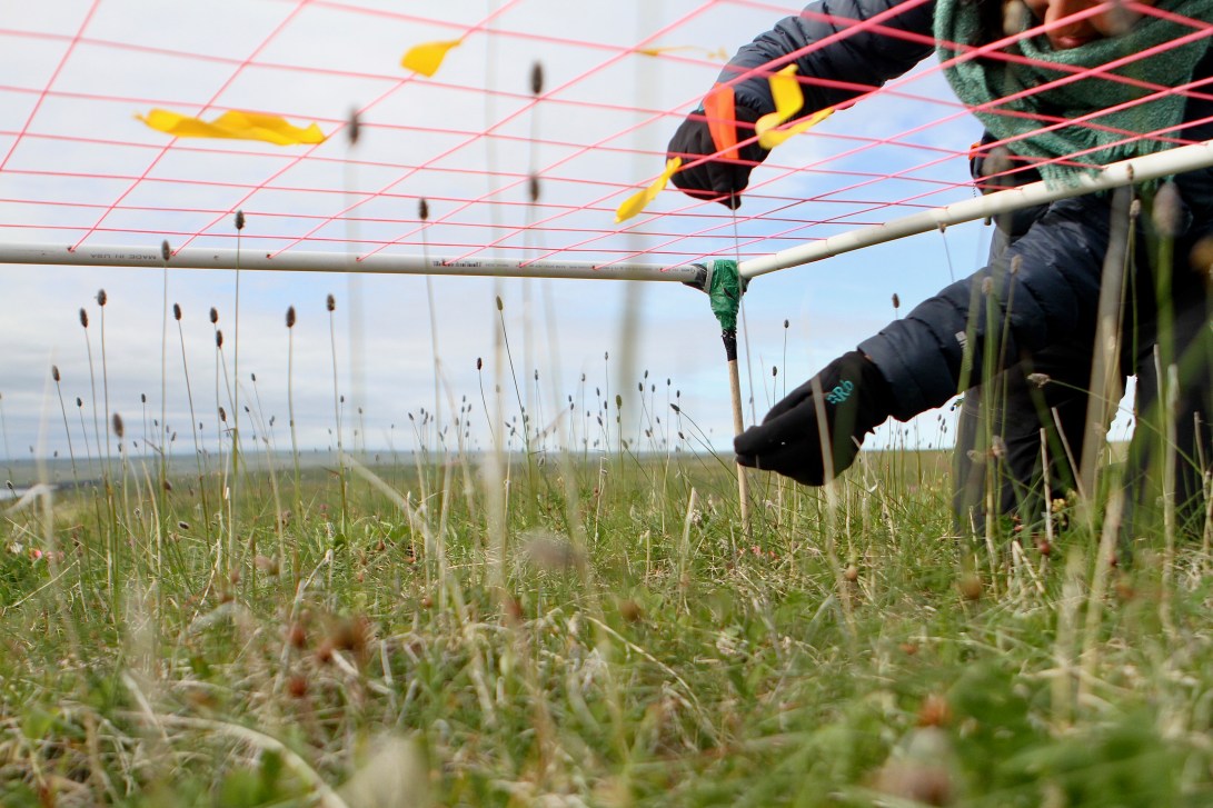
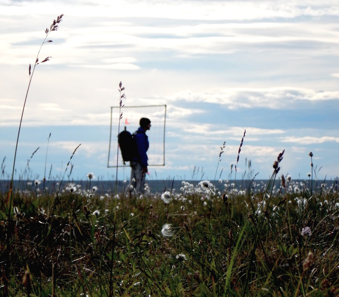
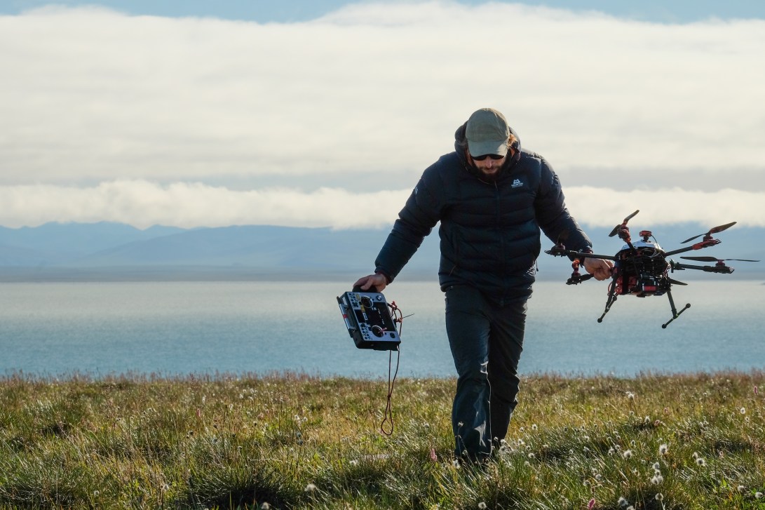
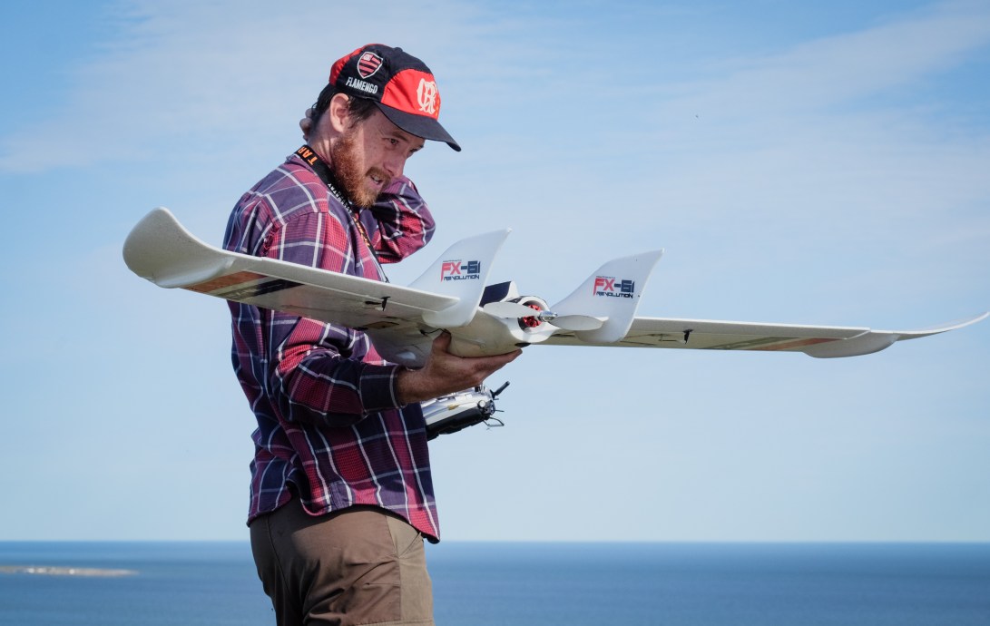
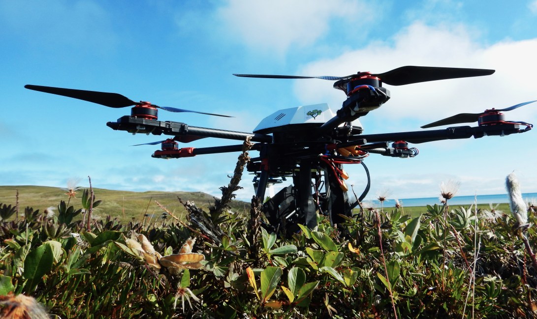
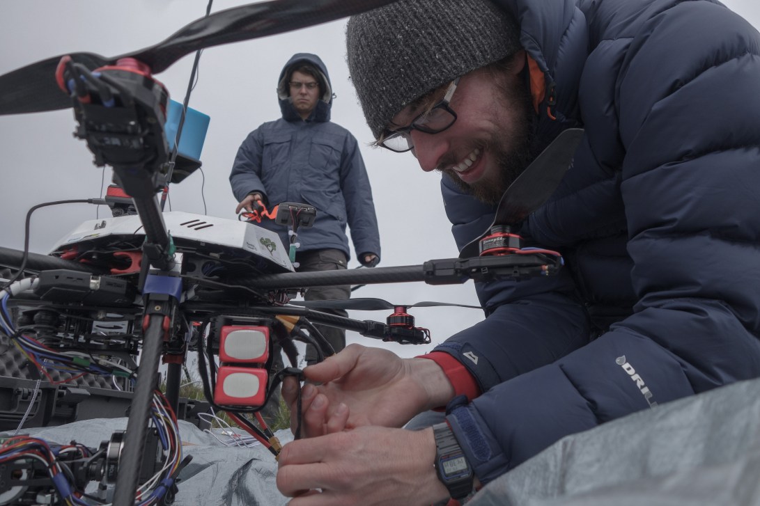
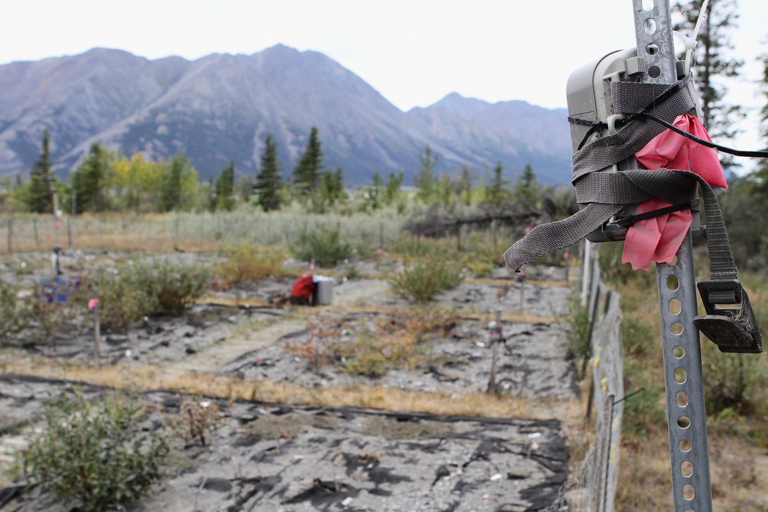
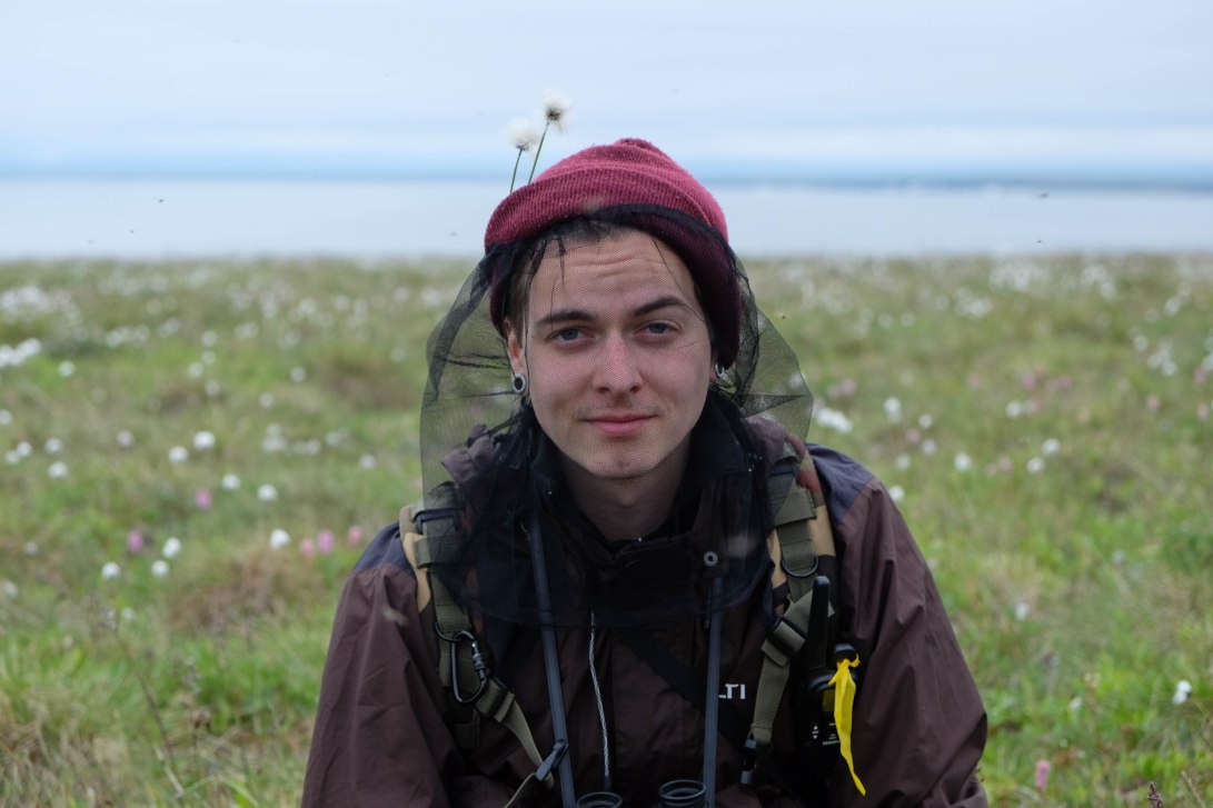
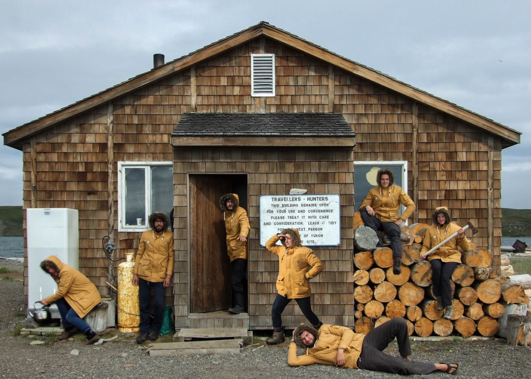
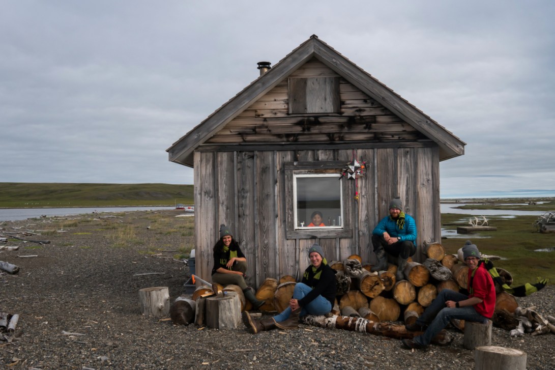
Scientific research in the Arctic is a team effort and a great way to celebrate is with a muddy permafrost high-five in a retrogressive thaw slump. Photo credit: Jeffrey T. KerbyArctic research, especially when it involves drones, means that we are often hiking with big backpacks full of equipment – a pre-requisite to successful data collection! Pictured here is part of our 2018 team hiking through a field of daisies on the way to Slump D – the largest retrogressive thaw slump on Qikiqtaruk and one of the largest in North America. Photo credit: Gergana N. DaskalovaScientific research in the Arctic is a team effort and a great way to celebrate is with a muddy permafrost high-five in a retrogressive thaw slump. Photo credit: Jeffrey T. KerbyA quadcopter drone takes off on Qikiqtaruk-Herschel Island for the first time in 2017. Though the conditions on our first day on the island were far from suitable for collecting drone data for scientific purposes, the atmospheric mist and moving sea ice made for a mesmerising view, all the more impressive when seen from above. Photo credit: Gergana N. DaskalovaMost of Qikiqtaruk-Herschel Island is underlain by ice-rich permafrost. The very top layer of this permafrost thaws during the summer and then re-freezes as winter approaches – the active layer. Climate warming has been linked to a deepening of the active layer – each year more of the permafrost thaws, thus changing the conditions in which plants grow in the Arctic. To find out how active layer depth is changing, we use a metal probe to record how deep into the ground it goes before hitting ice. Over the last 20 years, active layer depth on Qikiqtaruk has almost doubled. Photo credit: Jeffrey T. KerbyWith more than half of the world’s soil carbon stored below ground in high-latitude ecosystems and up to 80% of tundra biomass being found below ground, what happens in the soil really matters! Here, we dug up a half-metre wide tundra willow only to find roots extending for more than 5 metres in all directions. Photo credit: Sandra Angers-BlondinA pin drops in the tundra. And then 11,999 more pin drops follow. Every year we monitor the composition and structure of plant communities on Qikiqtaruk-Herschel Island, and one of our key tools is a thin metal pin flag. By recording the types of plants the pin touches every time we drop it, we can get insights into how plant communities are changing from one year to the next. Photo credit: Mariana García Criado & Gergana Daskalova Sometimes the role of a researcher can be quite lonely, like when you spend long days out on the tundra tediously collecting detailed measurements of vegetation change. Here, on Qikiqtaruk-Herschel Island off the coast of the Yukon Territory, ecological monitoring of tundra vegetation has been conducted since 1999. Only with long-term records such as this can we understand the rate and drivers of vegetation change around the tundra biome. Photo credit: Isla H. Myers-SmithJakob Assmann carrying the hexacopter drone to the landing pad. He is about to launch a mission to map the timing of the greening and yellowing of the tundra landscape. Photo credit: Sandra Angers-BlondinJeff Kerby pondering the flight plan for an FX-61 flying-wing fixed wing drone before take-off to monitor the changing tundra landscape. Photo credit: Sandra Angers-BlondinTo monitor vegetation change in the Canadian Arctic, tundra ecologists are now turning to new technology such as drones. This hexacopter platform that we call Shrubcopter and its companion platform ‘Droney McDrone Face’ took to the skies in the summers of 2015 and 2016. The drones have captured imagery of tundra landscapes to monitor changes in the green-up and growth of plants and to quantify rates of permafrost thaw on Qikiqtaruk-Herschel Island of the Arctic coast of the Yukon Territory. Photo credit: Isla H. Myers-SmithWorking with drones in the remote Arctic requires lots of maintenance and troubleshooting. Here, Jakob Assmann checks the connections before take-off with his ground control station operator Santeri Lehtonen in the background. Photo credit: Jeffrey T. KerbyThis willow sample made it to our common garden in Kluane all the way from Qikiqtaruk-Herschel Island. Here, this willow will experience warmer conditions than its previous island home. As the garden continues to grow, we will find out if those warmer conditions will spur faster, more exuberant, growth. Photo credit: Gergana N. DaskalovaPhenocams (a time-lapse camera) allow us to track phenology – the timing of life events like first leaves appearing in the spring – even when we are not in Kluane. The willows growing in the garden come from the peaks of the mountains around it and as far as Qikiqtaruk – 1000km further north! Photo credit: Gergana N. DaskalovaScientific research on Qikiqtaruk – Herschel Island is a collaboration between park rangers and visiting scientists including Team Shrub. Here, we are checking the phenology monitoring transect together. In operation since 1999, this is one of the longest monitoring datasets of its kind in the Arctic. Photo credit: Sandra Angers-BlondinOn Team Shrub, we love a good jumping shot like this one taken in the base of the massive permafrost disturbance Slump D. Photo credit: Jeffrey T. KerbyArctic fieldwork can mean dealing with a few (millions) of mosquitoes, hence some fashionable outfits like this one! Photo credit: Sandra Angers-BlondinThe Team Shrub field team in 2015. Photo credit: Sandra Angers-BlondinThe Team Shrub field team in 2016. Photo credit: Sandra Angers-BlondinTeam Kluane 2017: The divided Team Shrub field teams in 2017 – Team Kluane. Photo credit: Gergana N. DaskalovaTeam Drone 2017: The divided Team Shrub field teams in 2017 – Team Drone. Photo credit: Gergana N. Daskalova
Copyright for the images is with the authors. Please get in touch if you are interested in using any of our photos.