Copyright for the images is with the authors. Please get in touch if you are interested in using any of our photos.
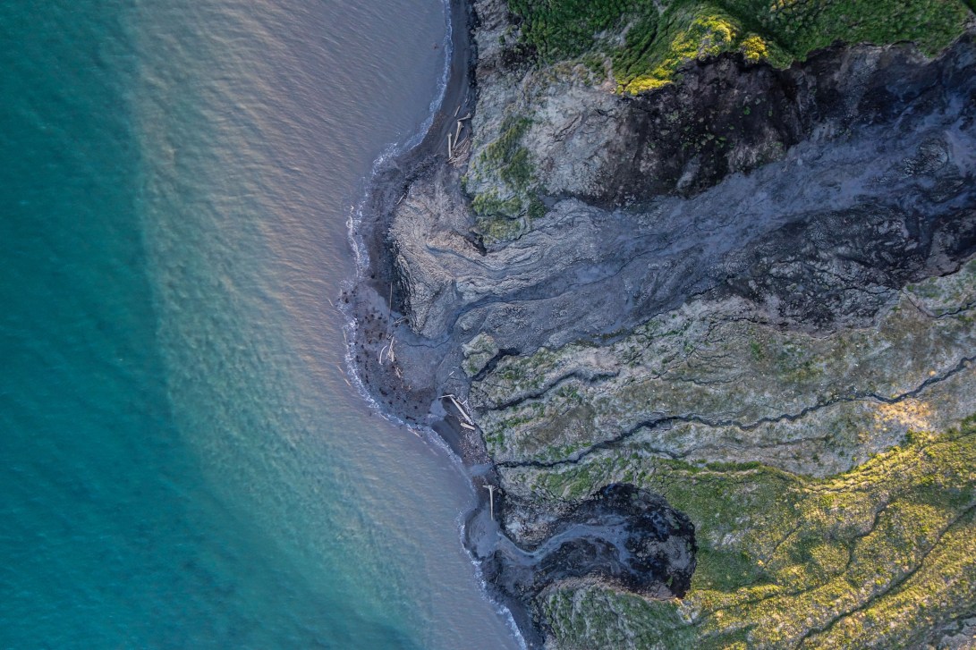
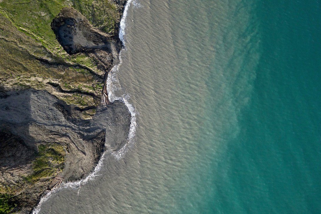
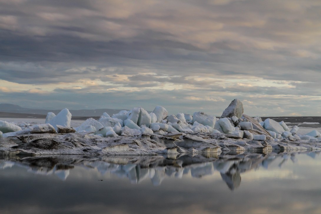
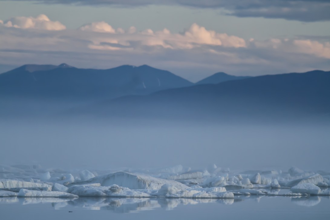
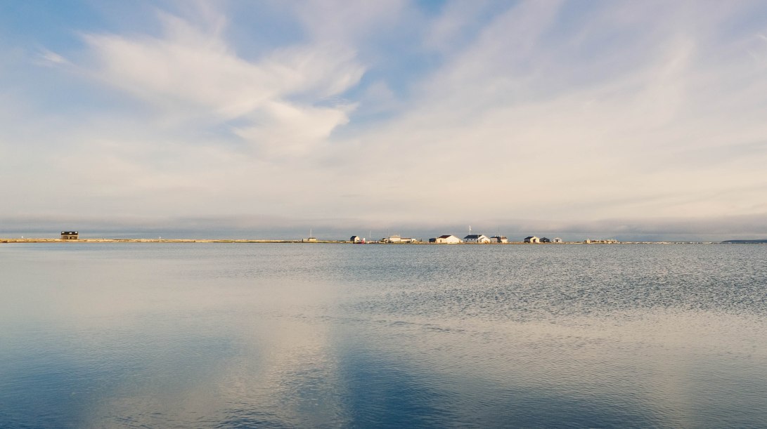
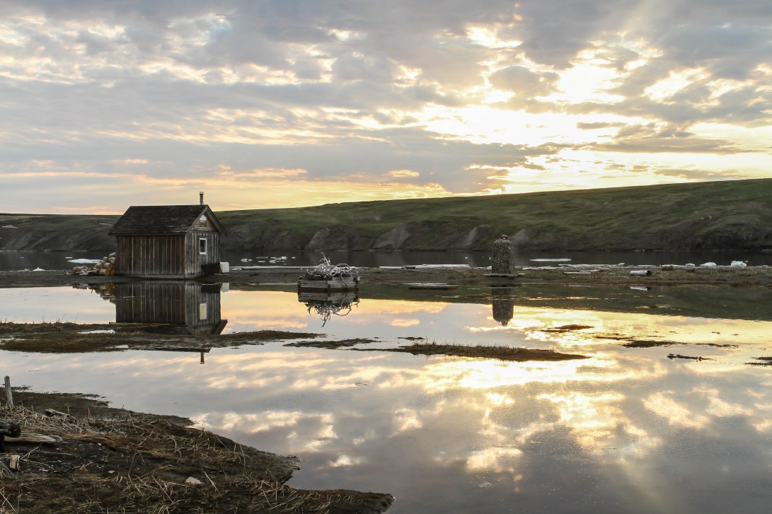
The places where the land meets the water create some of the most interesting visual patterns in the tundra landscape. As the thawing frozen ground flows into the ocean, the waters are turned from Arctic blue to silty grey due to the eroding sediment. Photo credit: Jeffrey T. KerbyArctic landscapes are degrading. As permafrost (permanently frozen ground) thaws and coastlines erode, sediments are transported out into the ocean, turning the turquoise water grey. Rates of coastal erosion have always been high along this particular coastline оn Qikiqtaruk – Herschel Island, but they may be accelerating in recent years as the sea-ice-free period becomes longer, more intense storms batter the ice-free coasts in summer, and warmer temperatures contribute to faster rates of permafrost thaw. Photo credit: Jeffrey T. KerbySea ice break up and retreat mark the arrival of summer on Qikiqtaruk-Herschel Island. This pile of ice blocks was our last glimpse of sea ice for the season. As the sea ice drifted further away into the horizon, we saw an entire ecosystem on the move – birds flocked to the island to breed, and shrub leaf buds burst open. Photo credit: Gergana N. DaskalovaOn a mystical late evening in the Arctic, a clearing amidst the fog reveals that there is still sea ice along the shores of Qikiqtaruk-Herschel Island. Arctic weather can be unpredictable, and wind and ocean currents can bring back ice even after you thought you’ve bid goodbye to the ice for the summer. Photo credit: Gergana N. DaskalovaThe still waters of Pauline Cove or Ilutaq with the historic buildings of the European Whaling Camp and former RCMP (Royal Canadian Mounted Police) station including the Community Building, the oldest building in the Yukon Territory. This historic site is so close to the ocean that it is threatened with flooding during storms and high tides. Photo credit: Sandra Angers-BlondinA fiery sunset on Hudson Bay, Northern Québec, from the Inuit village of Umiujaq. Photo credit: Sandra Angers-BlondinThe annual visit of the CCGS (Canadian Coast Guard Ship) Sir Wilfrid Laurier Icebreaker to Qikiqtaruk – Herschel Island in the long light of an Arctic summer night. Photo credit: Sandra Angers-BlondinMisty morning on Great Whale River, Northern Québec. The area is known for its large population of belugas. It is a traditional hunting ground for Inuit and Cree people, and the villages of Kuujjuarapik (“the little great river”) and Whapmagoostui (“where the whales are”) can be found at the mouth of the river on the coast of Hudson Bay. Photo credit: Sandra Angers-BlondinThere is a special time during the Arctic summer when you can watch the sunset, and then only moments later, watch the sunrise. As we dash across camp from one building to another, we often stop, mesmerised by intense sunsets and sunrises, made all the more impressive by the colours and clouds reflected in the calm Arctic waters. Photo credit: Gergana N. DaskalovaFlying over the Wrangle-St. Elias Ice Fields in the Kluane region, Yukon Territory. The clarity of the melt water hints at the depth of the crevasses in the ice. As glacier ice melts, the water can drain out of surface ponds, lubricating the base of the glacier and sometimes leading to rapid glacial advance, as it has been previously observed on the edges of this ice field. Photo credit: Sandra Angers-Blondin
The midnight sun dips close to the horizon, casting the tent shelters and the CCGS (Canadian Coast Guard Ship) Sir Wilfrid Laurier ice breaker into shadows.
Video credit: Sandra Angers-Blondin
Copyright for the images is with the authors. Please get in touch if you are interested in using any of our photos.